
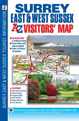
This full colour visitors' map of Surrey, East Sussex & West Sussex features road mapping that covers an area extending to: •The south coast from Portsmouth to Hastings •Ashford (Kent) and Faversham to the east •Reading, central London, Gravesend and Sheerness to the north •Fareham and Basingstoke to the west. Map detail is shown at a clear 2.5 miles to 1 inch scale (1.6 kms to 1 cm) and includes the following features: •Motorways, service areas, primary routes and destinations, A & B roads, tolls, mileages, gradients 1:5 and steeper and county boundaries. •Full major road junction detail. •Selected safety camera locations with their maximum speed limits and fuel stations. •Selected places of interest, tourist information centres, caravan and camping sites and golf courses. •Areas of Outstanding Natural Beauty and the boundary to the UK's newest National Park, the South Downs National Park, are also shown. There are 2 separate index panels adjacent to the mapping: •An index to cities, towns, villages, hamlets and locations •A comprehensive places of interest index with the corresponding map symbol shown alongside each entry for easy identification.
| ISBN: | 9781782570240 |
| Publication date: | 31st July 2014 |
| Author: | AZ Maps |
| Publisher: | Geographers' A-Z Map Co Ltd an imprint of HarperCollins Publishers |
| Format: | Sheet map, folded |
| Pagination: | 1 pages |
| Genres: |
Travel maps and atlases Geographical reference works |