
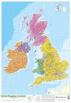
This detailed relief map of the United Kingdom and Ireland is colour coded to show the area of each country and large city. County boundaries are marked, as are rivers, motorways, ports and airports. An explanation of the political relationship between the countries is given, alongside information about the distance from sea level to Ben Nevis.
| ISBN: | 9780721709383 |
| Publication date: | 31st October 2002 |
| Author: | |
| Publisher: | Schofield & Sims Ltd |
| Format: | Poster |
| Genres: |
Travel maps Children’s / Teenage reference: Atlases and maps Children’s / Teenage stationery and miscellaneous items |